(All links confirmed as working – September 14, 2015)
As is common, we are in a drought again, here in California, and this makes the occurrence of wildfire more likely and also increases the damage that wildfires can do in the landscape and in populated areas. In an effort to stay in touch with the wildfire situation here in California, I have collected a set of resources to keep me informed when fires break out. While I live in the middle of the San Fernando Valley and fairly free from the direct danger of wildfire, fires in the surrounding areas can cause large problems with evacuations, smoke plumes and ash and also directly effect friends and family who live in or near wild lands.
“CAL FIRE is a State agency responsible for protecting natural resources from fire on land designated by the State Board of Forestry as State Responsibility Area (SRA). CAL FIRE also manages the State Forest system and has responsibility to enforce the forest practice regulations, which govern forestry practices on private and other non-federal lands. Two major themes are attendant to the CAL FIRE mission. One is the protection of the State’s merchantable timber on all non-federal lands from improper logging activities and the other is the protection of the State’s grass, brush, and tree covered watersheds in SRA from wildland fire. CAL FIRE is a “conservation agency” with origins stemming from the “Conservation Movement” of the last century.”
Cal Fire provides a number of online resources:
- Cal Fire Official Twitter Feeds
- Current Cal Fire Incident Information and Map
- Current Cal Fire Incident RSS Feed
“InciWeb is an interagency all-risk incident information management system. The system was developed with two primary missions:
Provide the public a single source of incident related information
Provide a standardized reporting tool for the Public Affairs community
A number of supporting systems automate the delivery of incident information to remote sources. This ensures that the information regarding active incidents is consistent, and the delivery is timely.”
InciWeb Resources:
- Photographs, News, Maps and more
- Current Fire Incident Information – Searchable and Sortable
- InciWeb Twitter Account
- InciWeb RSS Feed
- Google Earth KML of current fire incidents
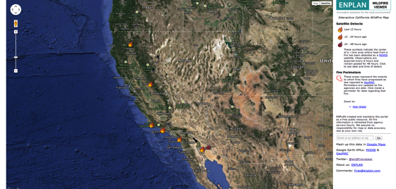
“ENPLAN provides environmental planning and geospatial information services and products to both public and private sectors. We have served over 500 clients since we began in 1980. Throughout our existence, we have remained absolutely committed to leading-edge quality and innovation in the solutions we deliver.”
Enplan Wildfire Viewer Resources:
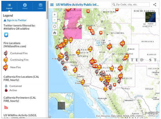
ESRI Integrated Fire Information Map
Resources include:
- Fire Locations
- Filtered Tweets
- Wildfire Perimeters
- Fire-Related Weather Watches and Warnings


